

Τώρα ακολουθείς τον/την
Σφάλμα στην ακολουθία χρήστη.
Αυτός ο χρήστης δεν επιτρέπει σε χρήστες να τον ακολουθούν.
Έχεις ήδη ακολουθήσει αυτό τον χρήστη.
Το πλάνο συνδρομή σου επιτρέπει μόνο 0 ακόλουθους. Κάνε αναβάθμιση εδώ.
Δεν ακολουθείς τον/την
Σφάλμα κατάργησης ακόλουθου χρήστη.
Έχεις προτείνει επιτυχώς τον/την
Σφάλμα πρότασης χρήστη.
Κάτι πήγε στραβά. Παρακαλούμε ανανέωσε τη σελίδα και δοκίμασε ξανά.
Επιτυχώς επαληθευμένο Email.

lahore,
pakistan
Τώρα είναι 11:42 π.μ. εδώ
Έγινε μέλος Ιουλίου 13, 2017
0 Recommendations
Muneeb A.
@MUNEEBAAMIR
0,0
0,0
0%
0%
lahore,
pakistan
Μ/Δ
Ολοκληρωμένες Δουλειές
Μ/Δ
Εντός Προϋπολογισμού
Μ/Δ
Εντός Χρόνου
Μ/Δ
Βαθμός Επανάληψης Πρόσληψης
Geospatial Expert
Επικοινώνησε με τον/την Muneeb A. για τη δουλειά σου
Συνδέσου για να συζητήσεις τις λεπτομέρειες μέσω τις συνομιλίας.
Πορτφόλιο
Πορτφόλιο


Preparation of Digital Elevation Model

Drone Mapping

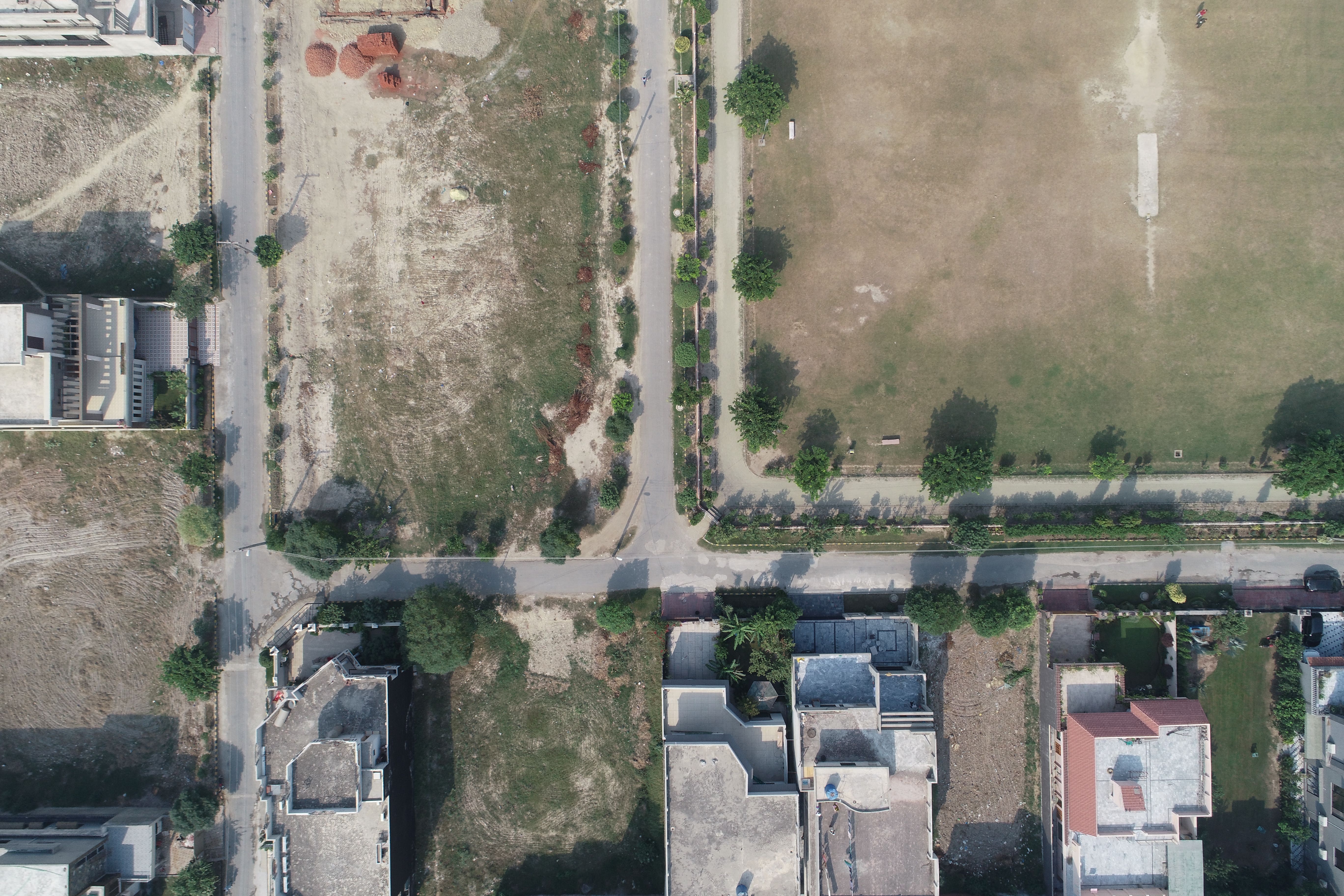
Drone Mapping

Drone Mapping
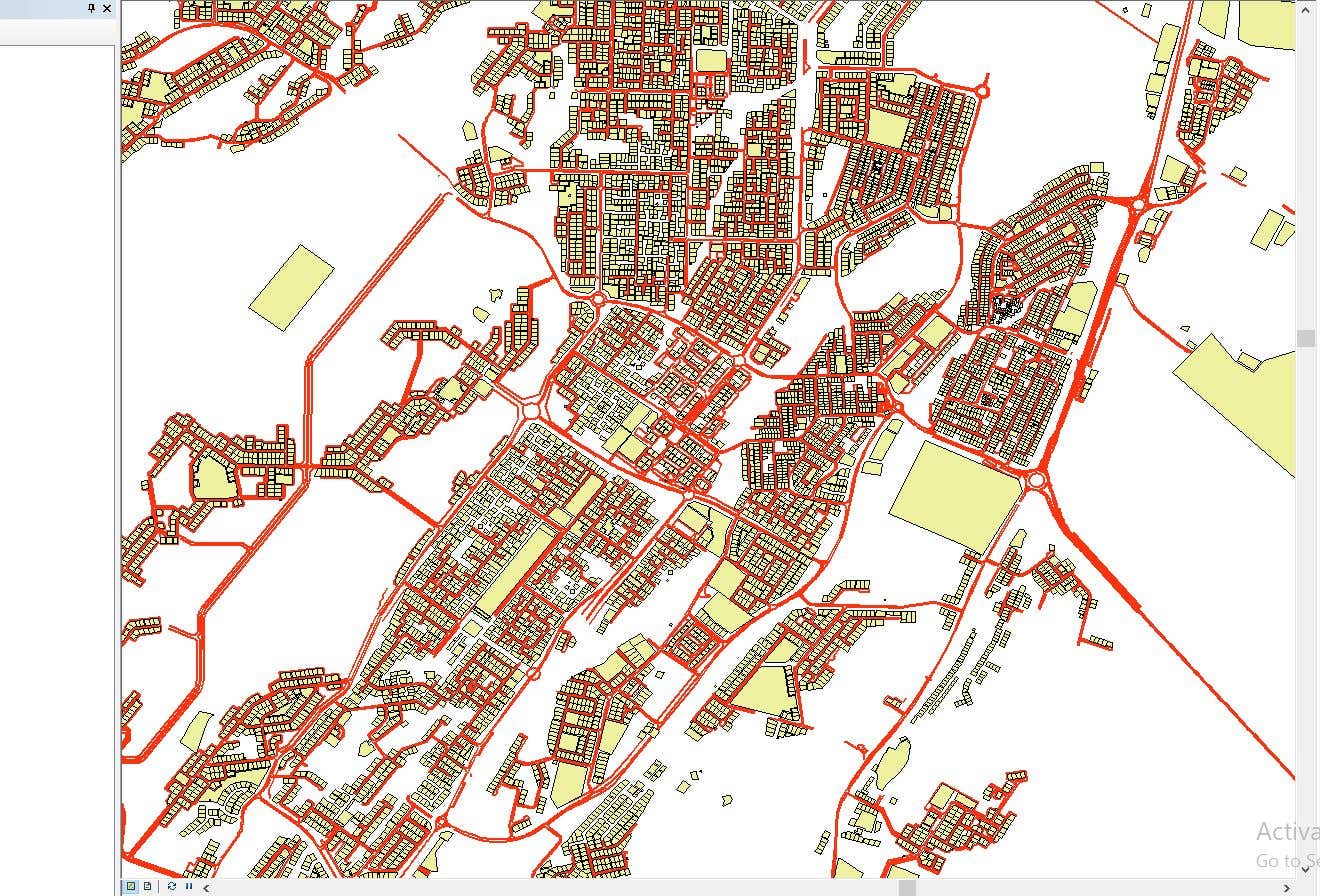

CAD to SHP Files

CAD to SHP Files
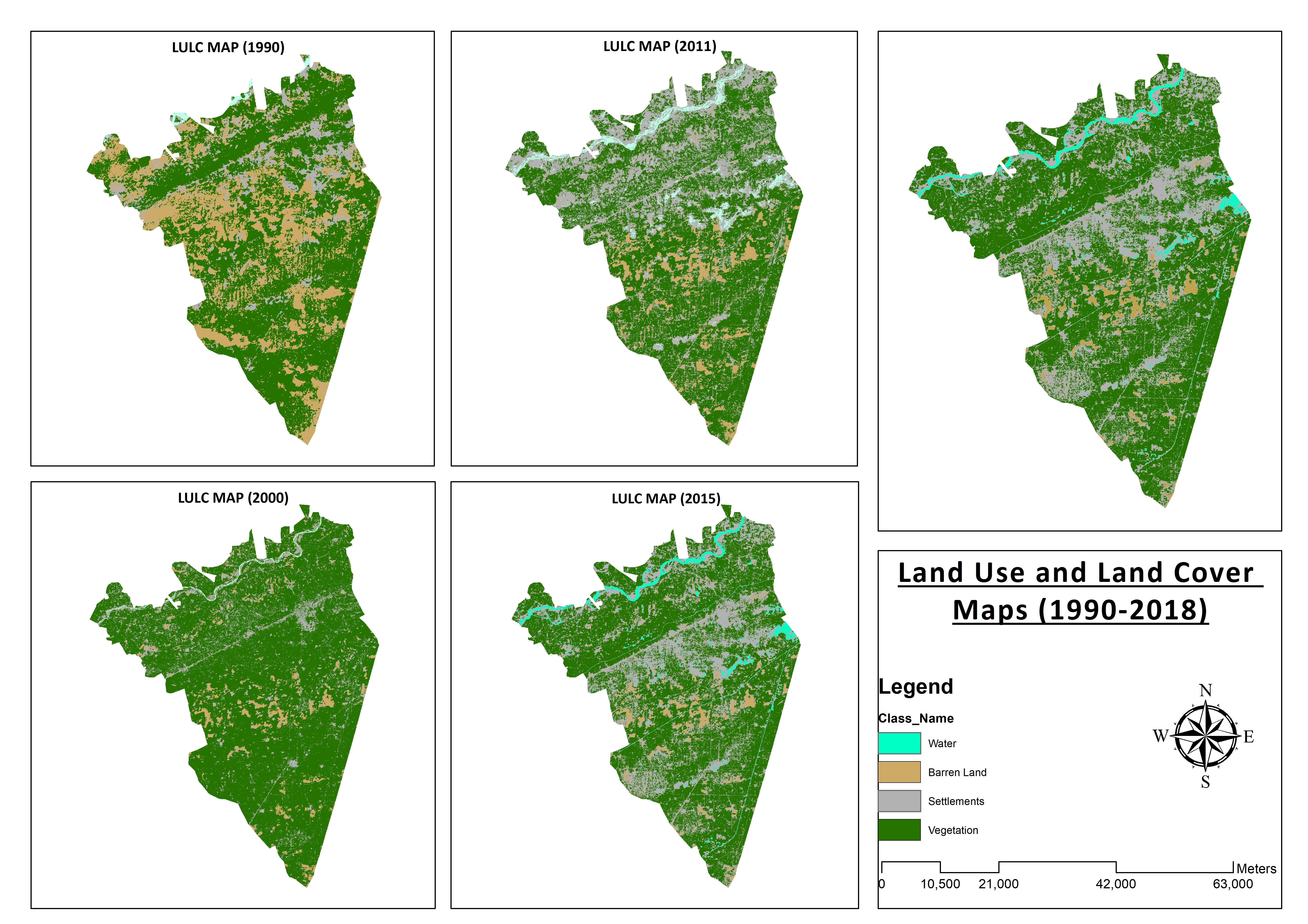

Land Use and Land Cover Maps
Preparation of Digital Elevation Model
Drone Mapping
Drone Mapping
Drone Mapping
CAD to SHP Files
CAD to SHP Files
Land Use and Land Cover Maps
Αξιολογήσεις
Οι αλλαγές αποθηκεύτηκαν
Δεν υπάρχουν αξιολογήσεις για να δεις εδώ!
Εμπειρία
Remote Sensing and GIS Analyst
Σεπ 2018 - Οκτ 2019 (1 χρόνο, 1 μήνας)
Developed, integrated and Implemented GIS and Geodesy based Topographic Survey Plans under different Hydro-Power Projects in Northern Pakistan, Extension of Canal Projects to increase its capacity in Sindh-Balochistan, Analysis of Suitable Site Selection for different development sites by using Drone for Aerial Mapping and their detailed pre-feasibility studies with different softwares, to analyse and interpret spatial data to produce interacting Maps and Reports while ensuring quality control.
Research Associate GIS
Οκτ 2015 - Οκτ 2018 (3 χρόνια)
Deployed GIS-based system under Urban Immovable Property Tax (UIPT) for Punjab Excise & Taxation Department. Provided comprehensive support in creating the system while take advantage of software suites like ArcGIS Suite and ERDAS Imagine. Prepared communicating maps to help surveyors in Analyzing geo-spatial data to verify it during ground truthing. Created shapefiles to merge topographical data with external data through layering process.
Εκπαίδευση
Master of Philosophy in Geographic Information System
(2 χρόνια)
Bachelors in Geographic Information System
(4 χρόνια)
Προσόντα
MS-Office
TEVTA
2017
MS-Office Certification in MS-Word, Excel and Power Point.
Εκδόσεις
Analysis of Flood Damage Assessment through Different Satellite Datasets in Southern Punjab,Pakistan
International Journal of Innovations in Science & Technology
RS and GIS techniques can achieve the objectives and significant analyses through visual interpretations. These techniques are also used to identify the flood affected regions. The study site was examined by applying supervised classification determining that 16900.96 Hectors of agriculture land was damaged while Sparse Riverine Forest had the area 44.52 hectors. The damaged built-up area was 1805.78 Hectors.
Estimation of Net Rice Production by Remote Sensing and Multi Source Datasets
Sarhad Journal Of Agriculture
Estimation of net crop production before harvest enables agronomists and decision makers to determine the volume of grain precisely. Yield estimation is one of the challenging tasks which is significant to evaluate accurately for farmers. This research was conducted in eastern Punjab Pakistan by incorporating yield/area as reported by Crop Reporting Service Department along with open source satellite datasets.
Επικοινώνησε με τον/την Muneeb A. για τη δουλειά σου
Συνδέσου για να συζητήσεις τις λεπτομέρειες μέσω τις συνομιλίας.
Επαληθεύσεις
Κορυφαίες Ικανότητες
Αναζήτησε Παρόμοιους Freelancers
Αναζήτησε Παρόμοιες Προβολές
Η πρόσκληση έχει σταλεί επιτυχώς!
Ευχαριστούμε! Σου έχουμε στείλει ένα email με ένα σύνδεσμο για να διεκδικήσεις τη δωρεάν πίστωση σου.
Κάτι πήγε στραβά κατά την προσπάθεια αποστολής του email σου. Παρακαλούμε δοκίμασε ξανά.
Η αντιγραφή στο πληκτρολόγιο απέτυχε, παρακαλούμε δοκίμασε ξανά αφού τροποποιήσεις τις άδειες σου.
Αντιγράφηκε στο πληκτρολόγιο.
Φόρτωση προεπισκόπησης
Δόθηκε πρόσβαση για Geolocation.
Η σύνδεση σου έχει λήξει και τώρα έχεις αποσυνδεθεί. Παρακαλούμε συνδέσου ξανά.